Northeast Braces for Unusual Late May Nor’easter: Rain, Wind, and Chilly Winds Ahead

May Nor’easter Delivers Unseasonably Chilly Conditions to the Northeast
It’s not every day that you hear about a nor’easter making headlines in late May. Typically associated with winter storms laden with snow, this weather phenomenon is reminding the Northeast that it can show its fierce side even in the warmer months. As the storm continues its march northward, the region is bracing for a nasty mix of rain, gusty winds, and undeniably chilly temperatures that will linger through Friday.
The Setup: What is a Nor’easter?
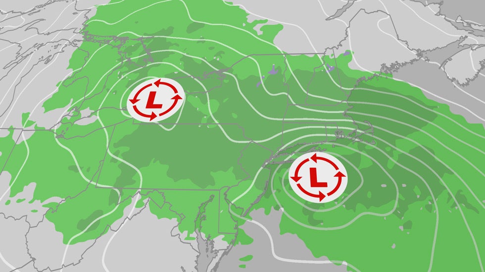
Nor’easters arise from a unique combination of atmospheric conditions, primarily where winds blow from the northeast over the Atlantic Ocean. These storms can bring everything from heavy snow to relentless rain, depending on the season and the specific weather patterns involved. The current nor’easter is categorized more as a nuisance, primarily delivering rain and wind rather than the wintertime snow accumulation usually associated with these storms.
Here’s what you need to know about the current situation:
- Rain: Heavy rainfall is expected, particularly across eastern New England, where totals could reach between 1 to 2 inches.
- Wind: Coastal winds could gust over 45 mph, creating situations that may lead to minor coastal flooding.
- Cold Temperatures: Mainly 10 to 20 degrees below average, with high temperatures only reaching the 50s this week.
Weather Impacts and Expectations
As the storm progresses, here’s what residents can expect:
Timing the Rain
The heavy rain and accompanying winds are expected to decline throughout much of the Northeast by Friday. Still, eastern New England—especially Maine—will maintain wind-driven rain well into the day. Areas with higher elevations in northern New England might even see some late-season snowfall.
Rainfall and Flooding Possibilities
Although not widespread, the risk of localized nuisance flooding exists, particularly in urban areas where drainage might be impeded. The following areas are likely to experience the heaviest rainfall impacts:
- Urban centers with poor drainage systems
- Low-lying areas prone to flooding
- Coastal regions where high tides could exacerbate flooding effects
Windy Conditions Across New England
The storm will also bring significant wind gusts, particularly along the New England coastline. These gusts could pose dangers such as:
- Snapped tree branches
- Downed power lines
- Minor coastal flooding
Residents along the coast should remain vigilant and prepare for possible disruptions caused by the wind-driven weather.
Temperature Drop and What It Means for Memorial Day Weekend
With temperatures expected to stay in the 50s for much of the region, locals will need to keep their jackets handy. There is some good news on the horizon as the weather pattern is expected to warm up in time for Memorial Day weekend. Forecasts indicate that temperatures may rise into the 60s, albeit still cool compared to seasonal averages.
This week’s surprising chill should serve as a reminder that Mother Nature can remain unpredictable even as we pass the traditional start of summer. Whether you’re making plans to enjoy the outdoors or simply staying cozy indoors, keep an eye on changing conditions.
As we approach the summer season, stay tuned to reliable weather updates to navigate the shifting climates ahead. Despite the current conditions, there’s light at the end of the tunnel—just in time for the holiday weekend.
Chris Dolce has been a senior digital meteorologist with weather.com for nearly 15 years after beginning his career with The Weather Channel in the early 2000s.